

Trail Name: Embleton Mountain
Distance: 8.9km
Time: 2 – 3 hrs
Difficulty: Hard
Cell Service: Unknown
Trail Conditions: Loose dirt, single track, fairly steep
Highlights: The views of Heffley a lake and surrounding hills from the summit are gorgeous. Once at the there, you’ll find a gazebo and picnic tables waiting for you. During the summer months, you’ll also enjoy a beautiful variety of mountain flowers.
To get there: Embleton Mountain is about 36 minutes from downtown Kamloops. From downtown Kamloops, head west down Lorne St. Turn left on Mt Paul Way and head over the Red Bridge. Continue 1.7km and turn left onto the Yellowhead Hwy. In 21km turn right onto Old Highway 5. Roughly 200m down the road, turn left onto Tod Mountain Rd. The trailhead will be on your left in 17km. You might see an earlier trailhead then this one. There are two. The second is a recommended starting point. Or get directions here.
The trailhead is well signed. There are many parking options. For this hike, we parked at the Heffley Lake recreation site on the other side of the road. Some people park at the cattleguard, just off the main road. Depending on what you’re driving, you can also drive over the cattleguard and head a little ways up the road. There are two well signed parking areas up the hill. Parking in either of these lots will shave 10 minutes or so off your ascent.
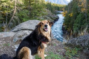
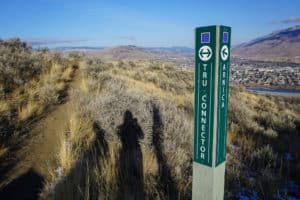
Because of the variety of trails in this network, it could be accessible by most. During our ascent we crossed paths with a group of 50 something ladies enjoying the hike and taking pictures of the flowers. The most challenging portion of the hike, which is completely avoidable to those who choose, is the steep slope along the ridge of the cliff. To avoid this section, keep to the right as much as possible during your ascent. The trails are extremely well signed with complete trail maps at nearly every major fork in the path. It would be difficult getting lost. The trail is very dog friendly. Just keep your eyes and ears open for coyotes in the area.

Katelyn B
16 Feb 2016Is the 8.9km the round trip distance, or one way?
HikeKamloops
19 Feb 2016The 8.9km was round trip! But keep in mind that there are multiple trails in the area, and I’m not sure we took the most direct route… So depending on which trails you follow, your path could be shorter or longer!
Marlaine
3 Jul 2017The road to P1 was pretty damaged from the spring run-off. I made it in 2WD in my SUV but I was definitely close to hitting bottom. I don’t think a car would make it.
Preet
12 Dec 2017Hiked on Dec 10 2017, took about 3.5 hours with breaks.
There’s half a foot ish of snow that really obscures the path in some areas, but apart from that the trail is well marked and fine. Download a map to make sure you’re heading the right way. Some slippery & very steep sections to the summit/lookout, but those can mostly be avoided by keeping to the right as suggested. Some areas of the fence crossing are damaged so use caution – specifically where the old mills/fence trail intersect below the aspen trail. Pics up on insta @ preeetc
Madison Adams
11 Apr 2018There is only cell service near the very top as the rest of the area is a dead zone. It’s pretty easy and you can make it up in one hour. I usually hike this trail once a week in the summer as I live not 5 minutes down the road.
Peter Willinam Embleton
15 Jul 2020Our family is preparing for a memorial hike to celebrate our Fathers life in September or October this year. I was up the mountain July 15th 2020 to check on a location to install his memorial plaque next to our mother’s plaque as per request from my father when he was alive. During this celebration we also will be spreading his ashes on top of the mountain that he loved so much.
To join us just email me, I can update you on the time a day we will be gathering to start the hike.