

Trail Name: Cinnamon Ridge
Distance: 4.9 km
Time: 2 hours
Difficulty: Hard
Cell Service: Yes
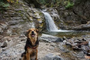
Dog Friendly: On-leash (BC parks) – but beware as there is a ton of cactus in the area.
Trail: The trail starts off with a steep climb up loose clay and rocks and then drops down into the gorge and follows the dried riverbed heading north.
Highlight: Hoodoos, views, and a dried up slot canyon!
To get there: This trail is about a 17 minute drive from downtown Kamloops. Follow Tranquille Dr towards the Kamloops airport. Continue down the road past the airport and the golf course. Just past Sunset Valley Farms, turn right onto Ord Rd. At the train crossing, drive over the tracks and turn left. Follow this single track dirt road, driving slowly to not kick up dust for the nearby residents. Follow Ord Rd to the end where you’ll enter a cul-de-sac. Park here. Or get directions from Google here. (Please note the Google Map does not take you fully to the cul-de-sac. Continue down the dirt road until you reach it)
Once parked, take the trail heading off towards Cinnamon Ridge on the right (North) side of the cul-de-sac. In about 300m you’ll come to a 4-way intersection, continue straight. You’ll come to another 3-way intersection where you’ll want to keep right. From here the trail really starts to climb as you make your way up the ridge. About 650m in, you’ll have summited a clay mound where, on the other side, you will be able to descend into the riverbed. From here, the trail is very straight forward as you follow the dried riverbed through a slot canyon and then a little ways up Mt. Mara.
This trail is truly unique to Kamloops and offers a look back into our history. Be sure to dress and pack appropriately as this southern facing slope, where cactus thrive, can get very hot. The trail itself is often quite steep with loose gravel or clay. We do not recommend this trail for young children or those unstable on their feet. Be sure to bring your camera and share your images with us on Facebook or by tagging #hikekamloops on Instagram!


Emily Bickel
21 Jul 2019Would not recommend bringing small children or pets as the trail can be a bit steep in sections. Make sure you read instructions carefully as it can be a easy to get lost during the beginning before the descent into old stream bed. If you find yourself climbing up any super steep terrain you have taken a wrong turn, be careful climbing any steep grades in area as erosion would be make these very difficult to climb down from. Bring plenty of water as this is in a hot area. proper footwear is a must. This is a hike to thoroughly research before doing as it helps with navigating to know what the trail looks like. Gravel road not in the best condition but driveable.
Canela
21 Aug 2019Awesome tip, friend
Kira M
27 Mar 2021The trail is in good dry condition today March 27th, 2021. We got to see some big horn sheep further up to the left of the hoodoos. This trail has lots of places where people have made their own trails so the markings can be very confusing at times. Proper footwear is a must on this as there is lots of loose dirt and steeper ledges. The canyon trail is stunning and I would highly recommend this for advanced hikers as some route finding is involved in some areas. The road on the way in has some deep ruts but it is completly dry so we drove the car down the road with caution in mind.
Roxanna
5 Jun 2021June 5th, 21
Loved, loved, loved this hike. Steep in sections for sure. There are way more trail options than I expected. Walked in the river bed for quite a ways, what a highlight. We did miss the trail to get out of the river bed and ended up rock climbing up a fairly steep
embankment, but it just added to the adventure (once we made it to the top!)…..
As noted, proper foot wear is important and poles are a benefit for sure.
Will do it again for sure!
Katherina Gountas
24 Aug 2021We went today and were surprised to see that the city has started adding markers along the trail. Unfortunately exactly where you would normally descend in to the creek bed there is a sign labelled cinnamon ridge that directs you to the right, up some sketchy switch backs to the actual ridge, which wasnt nearly as fun.
Carol & Martin
27 Oct 2021Hiked it today and it is really an adventure. You don‘t feel like being in Canada anymore. The signs fooled us for a moment, but turned around pretty soon to find the actual descent into the river bed. The climb up to Mara Mountain Hill at the end of the canyon was difficult and we got lost now and then. After all a cool, unique hike that took much longer than expected.